80 years of Cambridge’s changing railway landscapes: new online industrial gazetteer
From remnants of Victorian industry and transport to a Second World War defence system to recent transport additions such as Chisholm Trail Bridge, follow a five-kilometre walking/cycling route of industrial heritage from Cambridge North station to Cambridge station.

New perspectives on Cambridge’s railways
Volunteers of Cambridge Industrial Archaeology Group (CIAG) and Cambridgeshire Association for Local History (CALH) invite you to explore the city’s industrial heritage of railways.
Take a hike (or get on your bike!) with an online industrial gazetteer to launch on www.museumoftechnology.com to coincide with 2024 Cambridge Festival.
A route of industrial heritage: past, present (and future!)
The online gazetteer compiles archive and contemporary photography of industrial landmarks to show how railway lines, bridges, crossings and surrounding landscapes have been transformed: construction work in and around Cambridge railways is not only a 21st-century phenomenon!
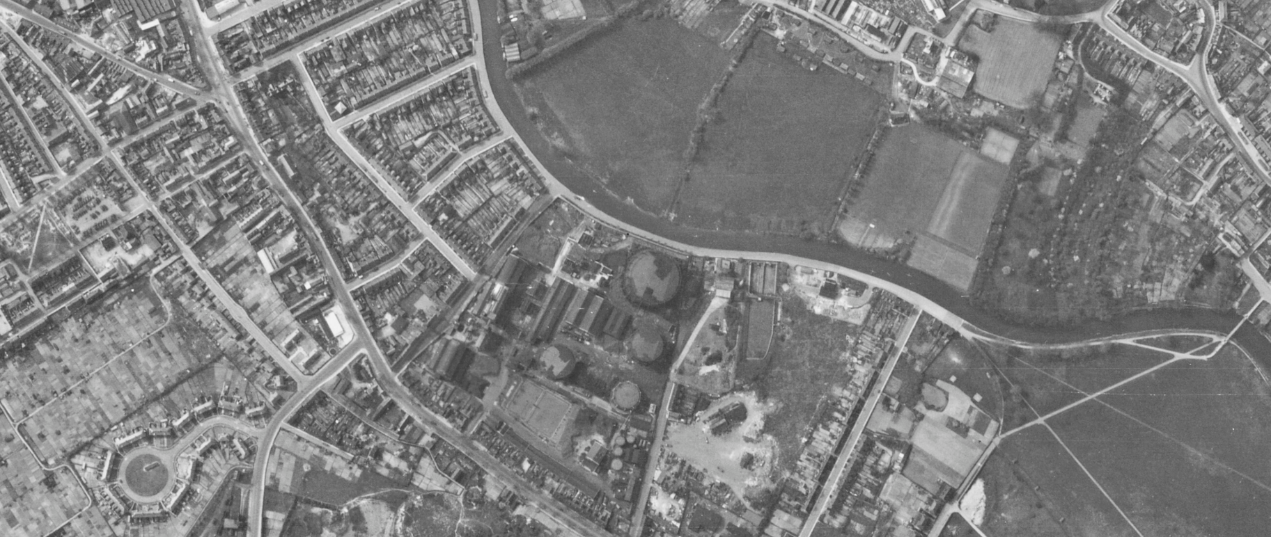
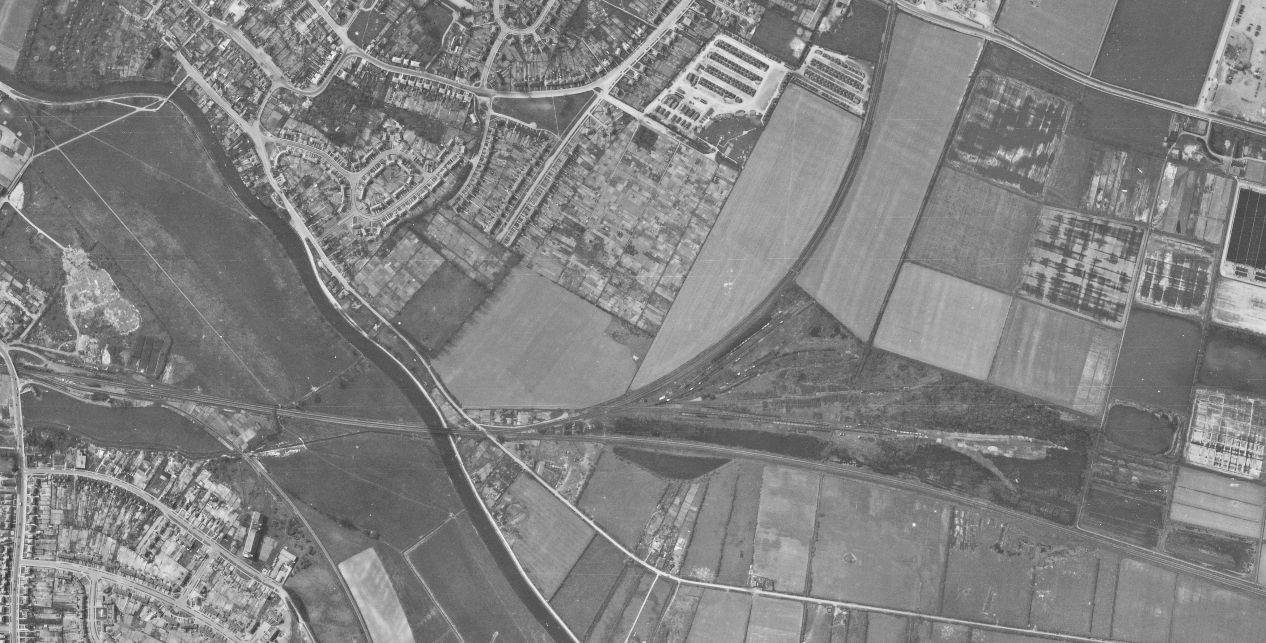
Past: 1944 aerial photograph of railway bridge over River Cam and Chesterton sidings (now Cambridge North railway station and Cambridgeshire guided busway) A concrete pill box (still visible today) was built on the north side of the river Cam, adjacent to the railway bridge, as part of a Second World War defence system.

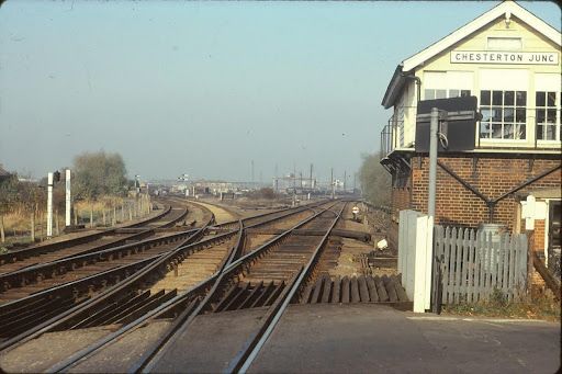
Past: Chesterton Junction 1975. The short-lived (1850) station probably lay in the angle between the main line to Ely (right) and the St Ives branch (left).

Present: Cambridge Cycle Bridge (Carter Bridge) opened 1989 at Cambridge Station


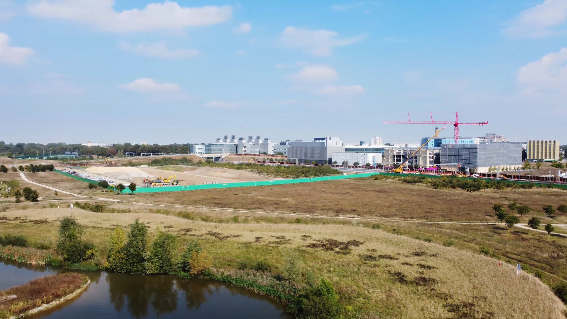
An accompanying film (in 2024 Cambridge Festival of Film) explores the early stages of construction at Cambridge South railway station.
Future: construction begins at Cambridge South railway station, 2023

About Cambridge Industrial Archaeology Group
CIAG studies and records the industrial history and artefacts of Cambridgeshire. The group is affiliated to the Association of Industrial Archaeology (AIA) and meets at Cambridge Museum of Technology (check online for meeting schedule).
About Cambridgeshire Association for Local History
Through its publications (a yearly ‘Review’ with substantial article on local history and a quarterly Newsletter), meetings (held at St John’s Church Hall, Hills Road, Cambridge at 2.15 on the first Saturday of the month from October to June), and its online presence at https://www.calh.org.uk/, CALH preserves and promotes knowledge of local history in the region.
Contributors to this article: Des Chalk, Gordon Davies, Pam Halls, Tony Kirby
Photo credits: 1944 aerial photos of Cambridge © Historic England under licence to Cambridge Museum of Technology
Drone photography: Aaron Greenwood (Fledermaus Media) | The Willcox Collective commissioned for Cambridge Museum of Technology under Creative Commons Licence: Attribution (Cambridge Museum of Technology) Non-Commercial International 4.0
Drones flown under UK Civil Aviation Authority Drone Code in co-operation with Cambridge City Airport